


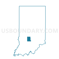
RICHLAND 09, Monroe County, Indiana
About
Outline

Summary
| Unique Area Identifier | 579813 |
| Name | RICHLAND 09 |
| County | Monroe County |
| State | Indiana |
| Area (square miles) | 0.18 |
| Land Area (square miles) | 0.18 |
| Water Area (square miles) | 0.00 |
| % of Land Area | 100.00 |
| % of Water Area | 0.00 |
| Latitude of the Internal Point | 39.16696430 |
| Longtitude of the Internal Point | -86.57710580 |
Maps


Graphs
Select a template below for downloading or customizing gragh for RICHLAND 09, Monroe County, Indiana


Neighbors
Neighoring Voting District (by Name) Neighboring Voting District on the Map
- BLOOMINGTON 06, Monroe County, IN
- BLOOMINGTON 15, Monroe County, IN
- RICHLAND 03, Monroe County, IN
- VAN BUREN 02, Monroe County, IN
Top 10 Neighboring County Subdivision (by Population) Neighboring County Subdivision on the Map
- Bloomington township, Monroe County, IN (44,167)
- Richland township, Monroe County, IN (14,343)
- Van Buren township, Monroe County, IN (11,981)
Top 10 Neighboring Place (by Population) Neighboring Place on the Map
Top 10 Neighboring Unified School District (by Population) Neighboring Unified School District on the Map
- Monroe County Community School Corporation, IN (120,715)
- Richland-Bean Blossom Community School Corporation, IN (17,259)